APPENDIX III - Some photographic evidence of the environmental impact of RMPV use in the area.
The accompanying photographs (with the exception of no.15) were taken on April 13th, 2007 after two weeks of mainly dry weather.
The photographs illustrate three particular features of RMPV use :
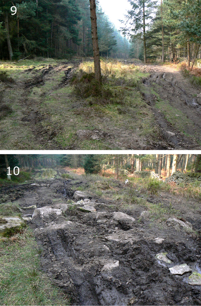
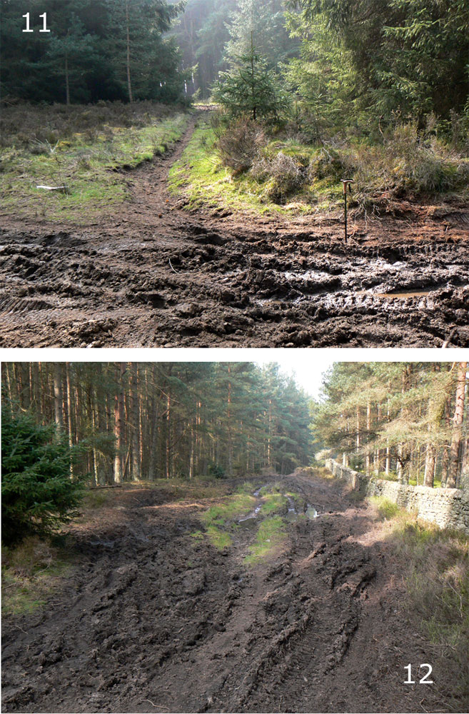
(i) the general damage done to unsurfaced tracks that renders them unsuitable for walkers (photographs 1,2, 3,4,5,6,9,10
(ii) the damage expands to fill the space available. Note that these BOATs are identified as being 60ft wide. In unfenced country there is no limit to the area that could be disturbed and damaged as vehicles seek to avoid impassable sections of the track (photographs 3, 4, 5, 6,9,10,12
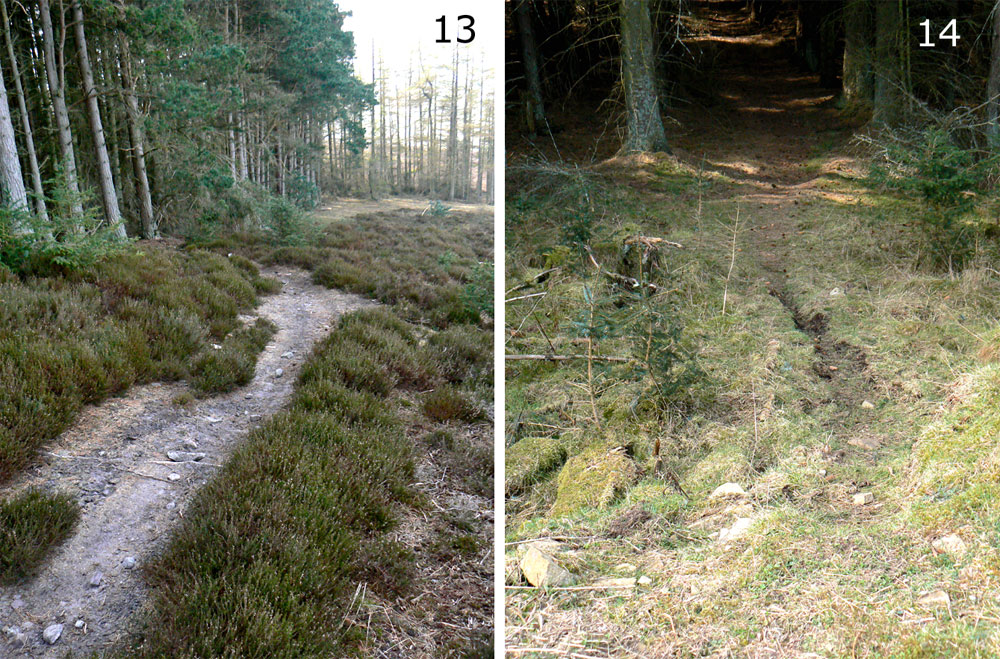
(iii) the creation of illegal “rat-runs”. In the sections photographed, at least four of these were identified, three apparently connecting the BOAT to a forestry road (photographs 7,8, 11,13,14) and the third by-passing two forestry gates on the BOAT by connecting to a forestry road.
The conclusion is that continued use of the boats is leading to an increasing area of ground damage, and to increasing numbers of illegal incursions off the BOATs, and that this will continue and increase, threatening the whole area under discussion.
DETAILS
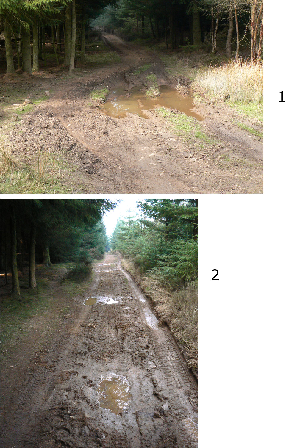
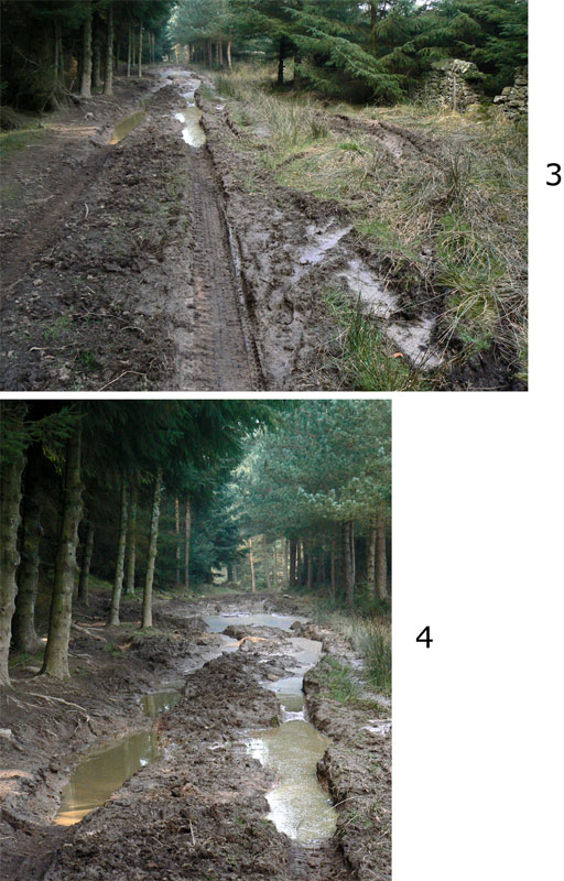
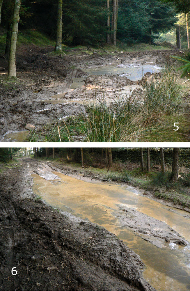
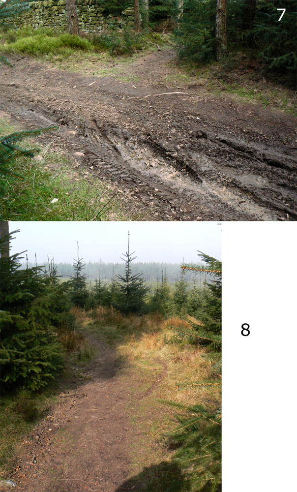
Photographs 1-10 were taken in succession heading west on the Gingleshaugh BOAT from the point where it separates from the metalled forestry road, to the point where it reaches the westerrn forest edge at Embley Fell near Viewley.
1. Ginglehaugh BOAT at junction of hard road with the unmade
section grid ref approx 947554.
2. Ginglehaugh BOAT , grid ref approx 944554.
3. Ginglehaugh BOAT, grid ref approx 944554.
4. Ginglehaugh BOAT, grid ref approx. 943554.
5. Ginglehaugh BOAT, just beyond (W of) 4.
6. Ginglehaugh BOAT just beyond 5.
7. Ginglehaugh BOAT. Illegal diversion north , from grid ref approx 942554.
8. Continuation of the illegal diversion off the GIngleshaugh BOAT at 942554 (see 7) heading west.
9. Gingleshaugh BOAT at approx grid ref 941554.
10. Gingleshaugh BOAT just west of 9. Some natural rock, with additions from the adjacent stone wall to create ramps to the bigger rocks.
11. Illegal spur south off Gingleshaugh BOAT, grid ref approx 939554. This appears to connect to the forestry road 100m to the south. The latter runs southward parallel with the forest-edge BOAT.
12. Gingleshaugh BOAT, grid ref 9938555.
13. Illegal diversion east off the Shire Road in direction of forestry road. Grid ref. approx 941548.
14. Illegal diversion south west off the forestry road at grid ref approx 943546, apparently cutting across to the forest edge BOAT.
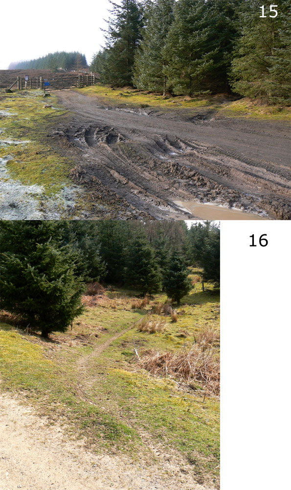
15. Eastern end of the illegal diversion shown in 16, showing the track entering the plantation from the Pennypie BOAT just north of the gate onto Blanchland Moor.
16. Illegal spur heading east off the forestry road at grid ref approx 953547. This cuts across to the Pennypie BOAT , joining it north of the gate onto the fell (see 15), and provides a link, via the forestry road westward to the Long Edge BOAT.